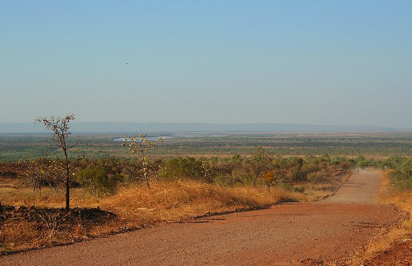
Bremer Bay Area GPS Waypoints.
GPS Waypoints for Bremer Bay and places of interest in the Bremer Bay area.
You can also download our maps for the Bremer Bay area for free, provided by 4-Wheeling-In-Western-Australia (4WDinWA).
Maps For Bremer Bay Area.
|
To download a printable map of greater Bremer-Bay click icon or click here. This map is in pdf. format, if you don’t have a pdf reader you can download one here. |
 |
|
To download a printable map of the Bremer-Bay Peninsula click this icon or click here. The map is in pdf. If you don’t have a pdf viewer it can be downloaded here. |
 |
GPS-waypoints.
|
For information about How to enter the GPS Way-points into Google Earth see this video. |
For information about How to enter the GPS Way-points into Google Earth
see this video.
The Heart of Bremer Bay (Estuary nearby):
|
Latitude: 34°23'33.68"S |
Longitude: 119°22'45.81"E |
Point Henry.
Point Henry:
|
Latitude: 34°28'48.02"S |
Longitude: 119°23'9.69"E |
Sparkle Island:
|
Latitude: 34°28'45.71"S |
Longitude: 119°22'2.57"E |

Wellstead Estuary.
Beaches close to Bremer Bay:
Bremer Beach Entrance (Estuary nearby):
|
Latitude: 34°23'36.79"S |
Longitude: 119°23'50.12"E |
Back Beach:
|
Latitude: 34°25'15.54"S |
Longitude: 119°23'26.23"E |
Fisheries Harbour & Beach (none 4x4):
|
Latitude: 34°25'30.68"S |
Longitude: 119°23'59.48"E |
Short Beach (none 4x4):
|
Latitude: 34°26'26.08"S |
Longitude: 119°23'48.95"E |
Entrance to Blossoms Beach:
|
Latitude: 34°27'16.94"S |
Longitude: 119°21'52.94"E |
Native Dog Beach (not driveable):
|
Latitude: 34°27'15.15"S |
Longitude: 119°21'42.79"E |
4WD Little Boat Harbour Beach:
|
Latitude: 34°28'10.44"S |
Longitude: 119°21'45.68"E |
Banky Beach (none driveable):
|
Latitude: 34°27'30.12"S |
Longitude: 119°23'23.33"E |
Doubtful Islands Bay:
Horse Beach:
|
Latitude: 34°21'54.56"S |
Longitude: 119°31'36.01"E |
Peppermint Beach (one of 2 Entrance's):
|
Latitude: 34°23'12.12"S |
Longitude: 119°29'32.11"E |
Doubtful Islands:
|
Latitude: 34°22'39.18"S |
Longitude: 119°34'11.22"E |
Dillon Bay Beaches:
Dillon Beach Entrance:
|
Latitude: 34°27'34.14"S |
Longitude: 119°16'41.00"E |
Dillon Beach south access:
|
Latitude: 34°27'41.89"S |
Longitude: 119°16'33.06"E |
Real Gnarly limestone hill climb:
|
Latitude: 34°28'10.29"S |
Longitude: 119°16'12.84"E |
WP16: Big hill descent:
|
Latitude: 32°59'41.12"S |
Longitude: 116°14'15.04"E |
Track to Stream Beach (600m steep descent to Stream Beach):
|
Latitude: 34°29'2.97"S |
Longitude: 119°16'11.11"E |
Stream Beach:
|
Latitude: 34°29'4.38"S |
Longitude: 119°16'29.91"E |
Reef Beach:
Entrance from highway:
|
Latitude: 34°24'12.80"S |
Longitude: 119° 2'29.31"E |
Reef Beach Entrance (head east from the shack):
|
Latitude: 34°27'37.86"S |
Longitude: 119° 4'46.15"E |
Exit track:
|
Latitude: 34°28'26.61"S |
Longitude: 119° 8'8.77"E |
Other Points of Interest:
Toolaburrup Hill Lookout:
|
Latitude: 34°26'29.10"S |
Longitude: 119°22'18.41"E |
Multiple Lookouts near Bremer Beach:
|
Latitude: 34°23'44.66"S |
Longitude: 119°24'23.49"E |
Town Wind Mill (get up real close to a massive wind turbine):
|
Latitude: 34°23'56.53"S |
Longitude: 119°23'29.38"E |
You might like these
resources
resources for 4-wheeling-in-western-australia.com/
Historic Tracks in Australia by 4 Wheel Drive.
Historic Tracks in Australia by 4WD, is Gibb River Road, Canning Stock Route or other historic tracks on your bucket list...
Esperance 4wd.
Enjoy Esperance 4wd, the rocky coastline and the squeaky clean beaches are the main attractions in this part of Western Australia. Follow the links here for 4wd tra.....

Recent Articles
-
Goodyear wrangler MTR
Jun 28, 24 10:27 PM
I have these on my defender 90 and my Dmax Ute. I get around 100,000 km out of them. I tried AT for one change and went back to the MTs. They are gol -
4x4 off road tracks 0 to 250 km from Perth
Nov 21, 23 07:40 PM
 On this page we cover 4x4 off road tracks within a 250 km radius from Perth...
 -
4 Wheeling Around Jurien Bay.
Nov 21, 23 07:35 PM
 Jurien Bay 4x4 tracks info and general information about the area...
- Home
- 500-750 km From Perth
- Bremer Bay
- Gps Waypoints
Leave GPS Waypoints And Go 4 Wheeling In Western Australia.


Privacy Policy | Disclaimer | Contact Us
By Brian Dahl, Copyright© 2012- All Rights Reserved