Cervantes to Jurien Bay.
Distance
from Perth: 205 km (under 3 hours’ drive)
Nearest fuel: Cervantes 3 km & (North) Jurien Bay 28 km.

Time to allow:
Cervantes to Jurien Bay can easily be done in 1 day, just make sure you start early to make the most of the tracks, beach and dunes.
Starting this trip 8-9 am will allow plenty of time to enjoy the dunes and the beaches.
Track length:
Once you add up navigating the dunes and winding sand tracks it ends up at about 25+ km's, it may not seem like a long trip
but adding a visit to the dunes, beach and then the Hill River for a little while and time will go by relatively quick!
Cervantes to Jurien Bay:
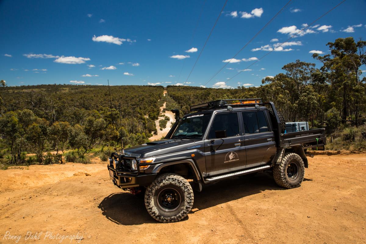
The Cervantes sand dune formations with Steep Sand Dunes, beach driving, sand tracks and river crossing is part of this trip.
The sand dunes will take a bit of exploring to navigate through, using our GPS way points provided below will ensure you are on the right path/direction.
The journey starts from Beach Rd in Cervantes.
Air down at the Y junction before commencing the Cervantes 4wd adventure.
Beach Rd will take you on to the beach instantly, drive just 100m and get off the beach by taking the track on the right.
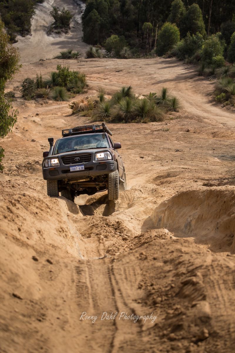
Once on the track keep left by staying on the main track until you approach the sand dunes, some of these dunes are very steep and offer a few good challenges.

The entire sand dune formation is an upside down V shape
which you will need to follow around and enter the track leading out of the
dunes by taking a left turn heading north.
From the first sand dune formation this is the only track heading north even when it peels off it joins back on to itself, keep going until the second sand dune formation has been reached.
The second sand dune formation is easy to navigate if wanting to just head
north and continue on, doing this just keep to the east side of the dunes
heading north and you will find the exit track at the other end.

We do however highly recommend spending some time exploring the sand dunes in this 2nd formation, on your Cervantes to Jurien Bay trip as there are yet again steep hill climb challenges.
Once out of the dunes and heading north along the bush tracks again you will
come across a gravel road and car park, here you could take an early exit back
to the highway by heading east on the gravel road. If you are up for more
adventure head north from the car park along the coastal sand track, this will
take you to the Hill River.
Approaching the Hill River tracks there may be flooded sections as the tracks
hug the river bank, while we were doing the Cervantes to Jurien Bay in October 2013 some flooded sections
were above knee deep so take care in winter.
Regardless of when you are there always check the depth, beware of snakes while walking the flooded sections, especially right next to the long grass by the river banks.

The Jeep Wrangler doing some water crossing on the Cervantes To Jurien Bay trip.
Once past the flooded tracks you will approach the beach and Hill River mouth, during our visit in October the river wasn't flowing out to the ocean and we could simply drive around the Hill River and continue on.
Just past the river mouth is a track which takes you off the beach heading back into the bush, this is one of the exit options.
Hugging the river using the tracks continue on into the bush, this track will take you to the Indian Ocean Highway.
Caution this track is very over grown and will result in pin striping, if this bothers you head back to the gravel car park and follow that to the high way.

Hill River mouth.
Places of interest, Cervantes To Jurien Bay:
The sand dunes are the main event on this trip, however there are a few great hidden treasures on the way through the tracks and that’s not including the million dollars view along the entire turquoise coloured coast.
There are great beaches and lime stone cliffs to checkout and a few sand dune challenges off the tracks which are well worth checking out!
See our GPS waypoints below and enter them into Google earth to make the most out of the trip!
Caution!
Check sand dunes for drop offs before driving up and over.
Know the tide.
Check the depth of water crossing.
There is plenty of wild life about due to this area not being visited too often so take care and stop for snakes, lizard or anything crossing.
Things To Do On Your Cervantes to Jurien Bay Trip:
4 Wheel Driving, Fishing, surfing, Kite surfing, swimming, sightseeing & exploring the sand dunes.

What to bring:
Air compressor, shovel, sunscreen, bush hat, plenty of water, rated recovery gear, Surf board, fishing gear, Sun shelter & Camera.
Cervantes To Jurien Bay, Best Time To Go:
September-April (best time to go)
May-August (still great if there is no rain)
Track conditions and difficulty:
Easy to Medium, the sand dunes always vary as they can change shape overnight.
Patches of very soft sand is always around somewhere in the dunes so bogging the vehicle is all ways possible.
The sand tracks have rocky sections and expect a bit of light pin striping from the bushes along the way, other than that the tracks are easy to drive and easy to navigate.
The only possible hard part of the tracks, Cervantes to Jurien Bay, could be the flooded sections of the track depending on the depth,
otherwise the entire trip is pretty easy, however playing in the sand dunes you can make it as challenging as you please.

Cervantes to Jurien Bay GPS Way points:
|
For information about How to enter the GPS Way-points into Google Earth see this video. |
For information about How to enter the GPS Way-points into Google Earth
see this video.
Start of the beach entry track (Air Down):
|
Latitude: 30°29'26.34"S |
Longitude: 115° 4'18.99"E |
Use the tracks running parallel to the shoreline:
|
Latitude: 30°29'14.00"S |
Longitude: 115° 4'17.81"E |
From this point onwards there is no beach driving required, the track will run parallel to the beach and will take you to the sand dunes:
|
Latitude: 30°28'39.33"S |
Longitude: 115° 4'17.74"E |
1st Sand Dune formation, navigate your way through to the next way point:
|
Latitude: 30°27'57.34"S |
Longitude: 115° 4'3.68"E |
1st Dune formation exit:
|
Latitude: 30°27'34.13"S |
Longitude: 115° 4'14.57"E |
At this way point there are 2 track options which lead to the same place, keep straight on heading north:
|
Latitude: 30°27'13.77"S |
Longitude: 114°59'55.13"E |

2nd Sand Dune formation, navigate through to the exit way point:
|
Latitude: 30°26'43.43"S |
Longitude: 115° 3'45.58"E |
2nd Sand Dune formation EXIT:
|
Latitude: 30°25'57.93"S |
Longitude: 115° 3'43.74"E |
The main coastal track, keep straight on (beach access if you turn left):
|
Latitude: 30°25'35.41"S |
Longitude: 115° 3'8.70"E |
Gravel car park. Options are head north for Hill River or head east along the gravel road for an early exit:
|
Latitude: 30°24'30.78"S |
Longitude: 115° 3'5.11"E |
3rd and final Sand Dune formation, keep left on these dunes close to the beach (within 50-150 m of the beach) and you will find the way through:
|
Latitude: 30°23'55.62"S |
Longitude: 115° 3'8.69"E |
3rd and final Sand Dune formation EXIT:
|
Latitude: 30°23'33.68"S |
Longitude: 115° 3'6.27"E |
Tracks leading to Hill River, beware of possible flooded tracks):
|
Latitude: 30°23'18.73"S |
Longitude: 115° 3'4.12"E |

Hill River mouth. Most of the time this river won’t connect to the ocean, however if it does take real good care before crossing:
|
Latitude: 30°23'4.50"S |
Longitude: 115° 3'0.58"E |
Around Hill River, get to this way point and simply follow the track. When multiple track options arise they all lead to the same point.
BEWARE!! If you are pin stripe sensitive, this track is not used very often and will pin stripe you 4x4 for the next 2-3km:
|
Latitude: 30°23'8.63"S |
Longitude: 115° 3'6.46"E |
Half way mark of the EXIT track:
|
Latitude: 30°21'43.62"S |
Longitude: 115° 3'31.61"E |
Turn left heading north for the Indian Ocean highway:
|
Latitude: 30°21'30.15"S |
Longitude: 115° 4'7.27"E |
Air up:
|
Latitude: 30°20'19.66"S |
Longitude: 115° 4'13.70"E |
You might like these
4x4 off road tracks 0 to 250 km from Perth
On this page we cover 4x4 off road tracks within a 250 km radius from Perth...
4 Wheeling Around Jurien Bay.
Jurien Bay 4x4 tracks info and general information about the area...
Mundaring power line track
At Mundaring you can enjoy an action packed day 4wheel driving
Recent Articles
-
Goodyear wrangler MTR
Jun 28, 24 10:27 PM
I have these on my defender 90 and my Dmax Ute. I get around 100,000 km out of them. I tried AT for one change and went back to the MTs. They are gol -
4x4 off road tracks 0 to 250 km from Perth
Nov 21, 23 07:40 PM
 On this page we cover 4x4 off road tracks within a 250 km radius from Perth...
 -
4 Wheeling Around Jurien Bay.
Nov 21, 23 07:35 PM
 Jurien Bay 4x4 tracks info and general information about the area...
- Home
- 0-250 From Perth
- Cervantes to Jurien Bay
Leave Cervantes To Jurien Bay And Go 4 Wheeling In Western Australia.


Privacy Policy | Disclaimer | Contact Us
By Brian Dahl, Copyright© 2012- All Rights Reserved